


The Ultimate Guide To The Best Hiking Apps In 2026: Hiking apps have become a handy tool for many walkers, helping with navigation, planning, weather, and photography. They are useful, but they should support your skills, not replace a paper map and compass.
Many hikers use apps differently. Some keep them as a backup, some plan routes digitally but navigate with paper maps, and others go fully digital. Each approach can work safely if you know what you’re doing.
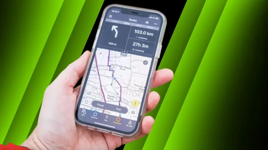
Google Maps will not cut it for hiking. At a minimum, the best hiking apps must offer detailed offline topographical mapping. Although several good options exist, for many years, ViewRanger was commonly recommended as the best choice; however, that was discontinued in 2022.
Best hiking apps for digital mapping and more
Best all-rounder
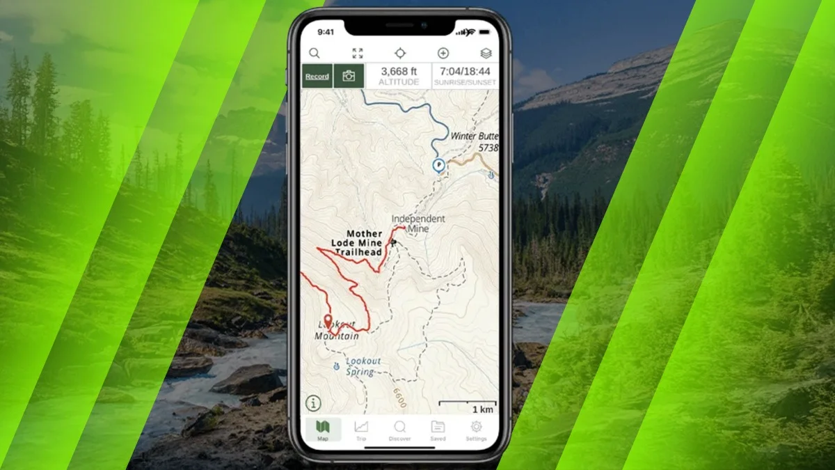
Gaia GPS
A strong choice for international treks thanks to its wide range of global topo maps and advanced tools. It lacks UK-specific OS mapping, but is excellent for power users heading overseas.
Outdooractive
A feature-packed app with worldwide maps, route planning, and community routes all in one place. The interface can feel complex at first, but it offers plenty for most hikers once you get used to it.
Topo GPS
Simple to look at but surprisingly powerful for advanced users who want speed and reliability. It focuses on strong mapping and planning tools and was awarded “Walkers app of the year” in our TGO reader awards.
MapOut
Clean, fast, and easy to use, making it ideal for visualising complicated routes or route collections. It works well as a secondary app but lacks the detailed mapping needed for serious mountain navigation.
Memory Map for All
A highly customisable app designed for experienced users who want full control over maps and data. It can feel complicated for beginners, and route planning features could be improved.
Best for simplicity
Komoot
Great for casual hikers who enjoy discovering and sharing routes with others. It works well on marked paths and is easy to use, though it’s less suitable for off-path mountain navigation.
OS Maps
A straightforward app with official OS mapping, grid references, and solid offline use. It integrates well with paper maps and covers the basics, even though it lacks some advanced features like waypoints.
Best for the weather
Met Office Weather App
Provides detailed hourly forecasts, summit conditions, and mountain hazard warnings. It needs a phone signal, so it’s best to check before heading into remote areas.
Blitzortung App
Shows real-time lightning strikes on a world map so you can track storms and make safer decisions. It’s fascinating to watch and especially useful when storms are building nearby.
Windy.com App
A global weather app with visual maps showing wind, rain, and cloud movement in real time. Great for overseas trips and understanding large weather patterns.
Best for safety
OS Locate
A simple safety-focused tool that provides quick grid references and elevation data for emergencies. It’s reliable, easy to read, and a smart addition to any hiker’s phone.
UK Map App
An old-school style navigation app with strong GPX handling and clear maps. The interface can feel confusing at first, but it works well for hikers who prefer data-heavy tools.
Other outdoor apps
Best for photographers
Photo Pills App
A powerful planning tool for photographers that shows sun, moon, and Milky Way positions. It takes time to learn but it can be extremely useful for planning camps and perfect shots.
ALSO READ: NordVPN Warns Your Phone Shares Data Overnight and How to Limit It